Ten New Hidden Gems of Orkney
Sometimes during the summer months, Orkney’s most popular attractions can be busy during the day. Thank goodness then that there are so many other fantastic places to discover – we like to call these hidden gems. These are ten places you can discover all by yourself, perfect for repeat visitors to Orkney, or for islanders looking for a fine walk when the weather is nice!
The Stromness Reservoir at Yelda Water, known locally as the Stromness waterworks is a popular place to visit as there are a number of brilliant walks to take nearby. Keen anglers will be delighted to know that there are also some great trout hiding in the dark depths!
See also:
Ten hidden gems of Orkney
Ten more hidden gems of Orkney
An extra ten hidden gems of Orkney
Ten further hidden gems of Orkney
Ten additional hidden gems of Orkney
Another ten hidden gems of Orkney
Ten other Hidden Gems of Orkney
A list of ten Orkney hidden gems
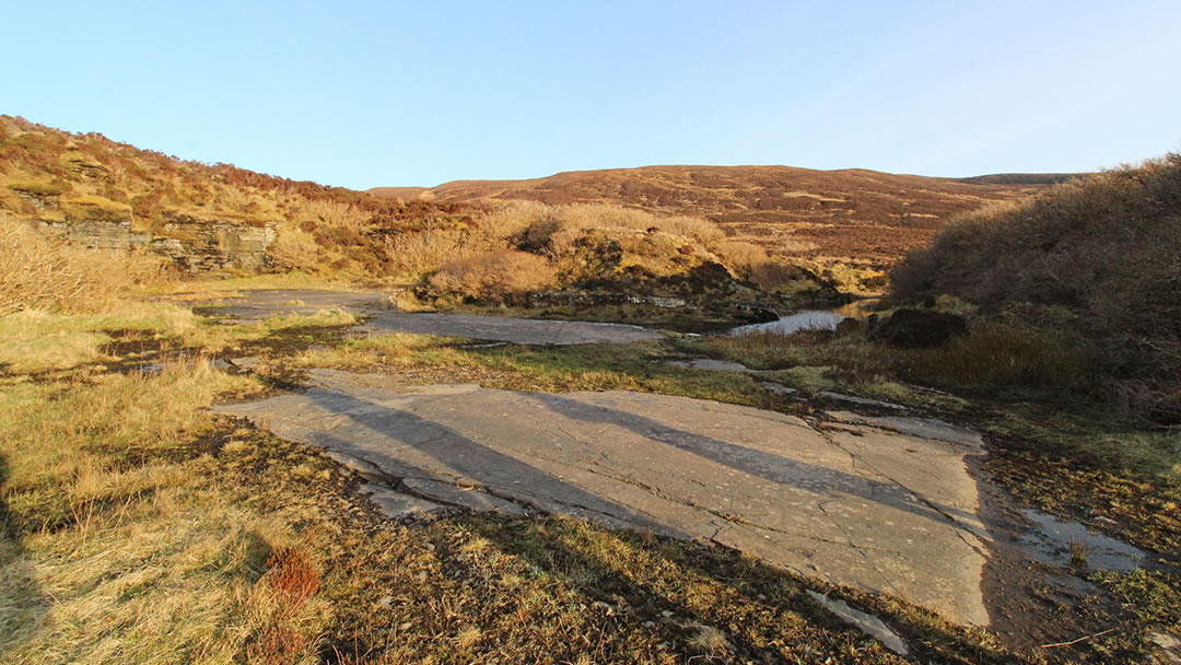
1) Russadale Quarry, Stenness
The best way to reach Russadale Quarry is to take Bigswell Road, which is directly opposite the road to the Standing Stones of Stenness and the Ring of Brodgar. Bigswell Road leads to Happy Valley, and you can park your car there. Then walk further along Bigswell road, until the next track to the right. Follow this uphill, past a bungalow, and when the track separates take the green footpath uphill.
The climb up to Russadale Quarry is gentle, on a rough path surrounded by heather, with a burn running nearby. After a 1/2 mile, the track turns up and round a corner into the lovely quarry, a sun trap sheltered from the wind, with a flat stone platform and a flooded area. In the summer there’s a bench so it doesn’t take much imagination to turn Russadale Quarry into the perfect picnic spot. Damselflies sometimes flit about, and my wife once came back from a winter walk at Russadale Quarry with amazing icy photos.
This was once a slate quarry, and in Peace’s Orkney and Shetland Almanac 1889, the Stenness Trades included Wm Cormack of Braemoor and Caleb Walter of Dowscarth as Slate Quarry Managers. An advert for a foreman appeared in the Orcadian of 19 April 1913, and in the 1921 census John Spence of Little Stoursdale was employed at the slate quarry. What date the operations ceased is, for now, unknown.
The trees at Russadale Quarry were planted by Edwin Harrold of Happy Valley. The story of the bench is that it was installed for Ruby Spence as a gift by grateful neighbours (she frequently walked their dog here). Take time to enjoy the amazing view of Neolithic Heart of Orkney on the way back downhill.
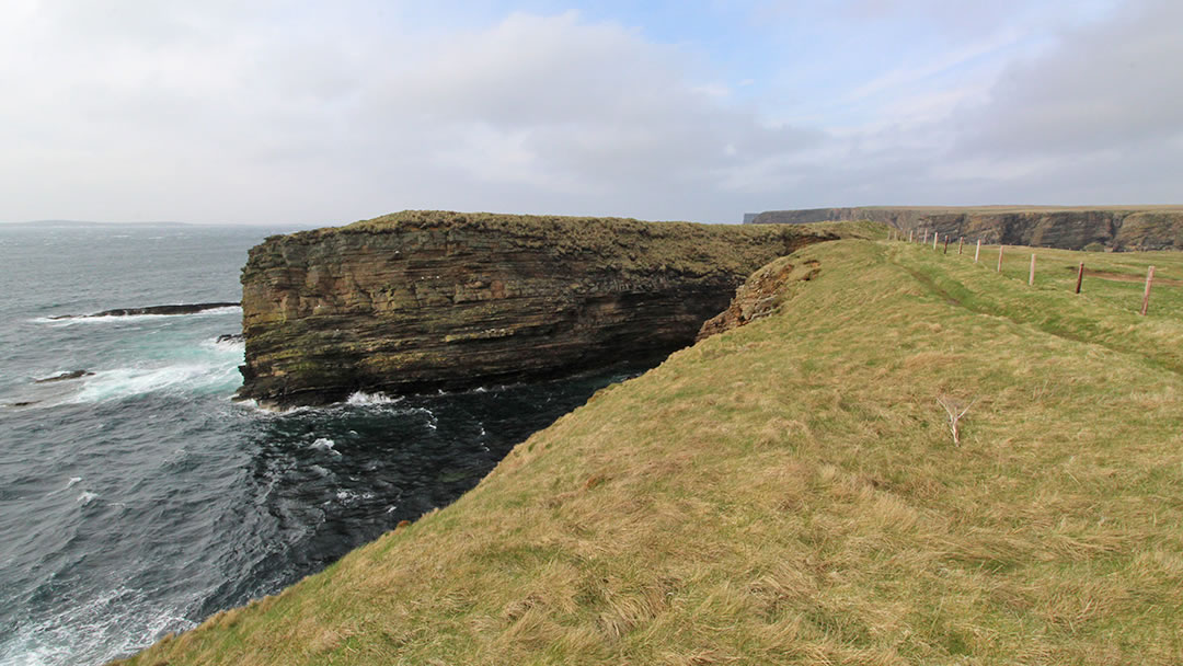
2) The Castle of Burwick, South Ronaldsay
At one of the southernmost tips of Orkney, there’s a hidden gem along a rugged coast. To reach the Castle of Burwick you may need to travel through South Ronaldsay to Burwick. Then take a short walk from the Burwick ferry terminal, up past two wind turbines, along a well-trodden coastal path. There are low cliffs here, views of Swona, and some interesting cliff scenery and sea stacks to the north.
The Castle of Burwick is a peninsula, a narrow sliver of land only just attached to the mainland. On your visit you may be able to spot evidence of a man-made ruins, ramparts, and ditches from around 100 BC (possibly a ruined broch?). It’s not far to reach from the car, but this coast is a very dramatic place to explore, and we struggled against a wild sea wind. We loved our visit to the Castle of Burwick!
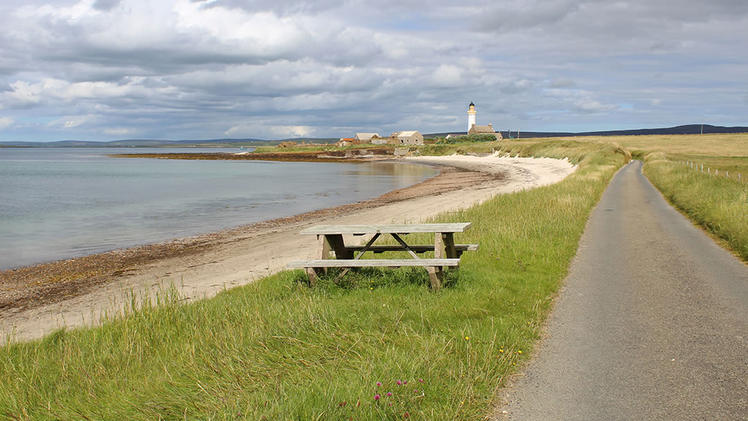
3) Sandside pier, Graemsay
Despite being close to Stromness, and a frequent stop for the ferry to Hoy, the island of Graemsay is not very often visited. When I asked my family to join me on a trip, they said no – they didn’t think there would be much to see. How wrong they were! I spend a delightful day on Graemsay, walking the coast, enjoying beautiful beaches, dramatic views and listening to birdsong.
The highlight was the wide crescent of golden sand at Sandside, and on the east side there is an old slipway which was built to assist with the construction of Graemsay’s two lighthouses in the 1840s. Rock was cut at the Point of Ness in Stromness, and then transported over to Sandside pier. Also at the Bay of Sandside there is a picnic bench, curious seals, and underfoot, the crunch of maerl. This is a kind of hard seaweed found in the water nearby. Sandside is very close to the pier for the ferry back to Stromness on the Orkney Mainland.
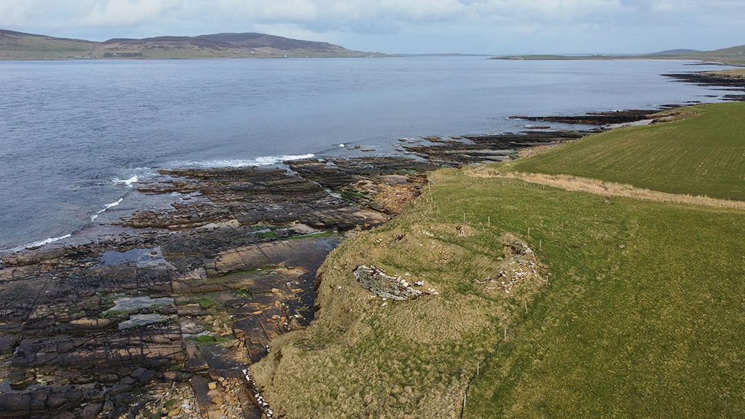
4) The Broch of Burgar, Evie
Burgar Hill in Evie was a test site for modern wind turbines, and these days several stand on the heathery hill, lazily spinning against the sky. However, on the shore below there is an engineering marvel from long ago, the Broch of Burgar. It’s a short walk down to the shore from the road and Burgar farm, and the broch is mostly caved in and overgrown now. The broch walls are most obvious from the beach underneath it. A silver hoard was found when the Broch of Burgar was excavated in the 19th century. So that the crown couldn’t claim this treasure, the story goes that the landowner threw it into the sea!
The tidal race here gave the parish of Evie its name, from the Old Norse efja meaning ‘a strong current in a river’. Once the green and fertile coast between Evie and Rousay was home to at least six brochs from the Iron Age. The most famous of these of course are the brochs at Gurness and Midhowe on Rousay, however we have a soft spot for this hidden gem!
The farmer at Burgar farm was very kind in letting us park nearby and walk through his farm. Please be sure to ask if it’s okay to pass through when visiting.
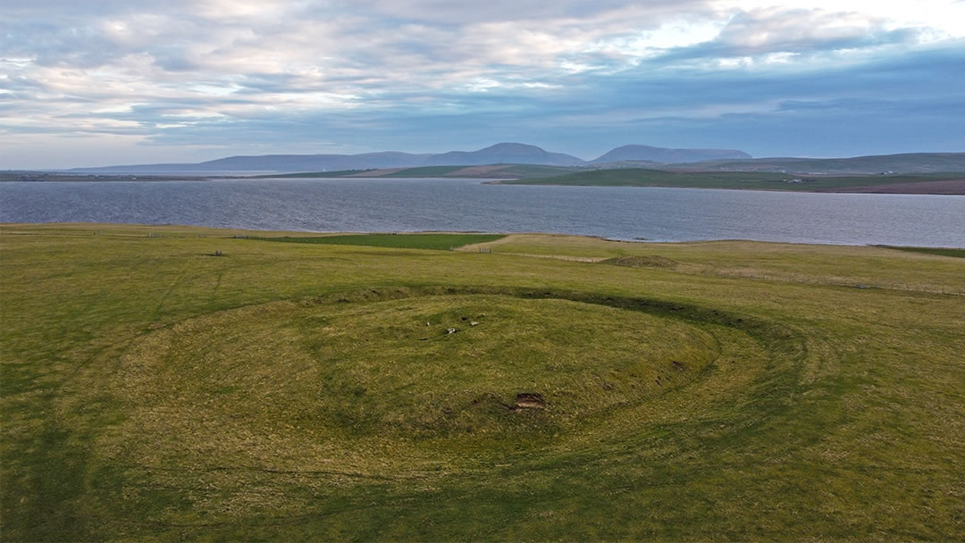
5) The Ring of Bookan, Stenness
On a grassy slope overlooking the Ring of Brodgar, Standing Stones and the Loch of Harray and Loch of Stenness, there’s an odd circle – the ground is marked by a 10m wide and 2m deep trench, which rises in the middle to a centre of oddly placed stones. It’s clear to see why the Ring of Bookan was once thought to be a henge monument, a much smaller version of the Ring of Brodgar. The Ring of Bookan is now understood to be the ruins of a chambered cairn rather than a circle of standing stones.
Over time the stones have been robbed, leaving not very much to see, and pottery and bones discovered during an 1861 excavation have been lost. However, the Ring of Bookan was important as its entrance faces the midsummer sunrise, and its placement, overlooking the lochs must have been significant to Neolithic people.
Please be aware that, unlike the Ring of Brodgar, the Ring of Bookan is on private land. A geophysical survey (see page 60 of the new book The Ness of Brodgar, Time and Place) shows that there are many ancient structures still to be discovered nearby.
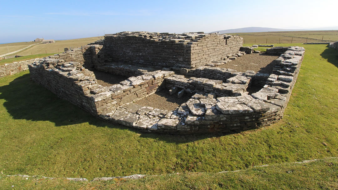
6) Cubbie Roo’s Castle, Wyre
Like Graemsay, we’d like to think of the whole of Wyre as a hidden gem. This tiny green island is a pleasant place to walk, and it’s easy to reach too, just a short ride on the ferry to Rousay from Tingwall in Evie.
At about the midway point of Wyre, there’s an ancient church, the farm where the poet Edwin Muir spent his childhood, and Cubbie Roo’s Castle. This once impressive structure was the fortress of a Viking chieftain, Kolbein Hruga, built in 1150. It’s quite small – the square keep is 8m across and the walls are 2m thick – so it was possibly a refuge from attack rather than a dwelling. After all, this was a time when Viking Earls such as St Magnus were killed in feuds.
Snaekoll Gunnason took refuge here in 1231 after murdering the last Norse Earl of Orkney, and the castle easily withstood the siege that followed. Perhaps the (slightly paranoid) reason this location was chosen for a castle, visitors can enjoy a stunning panoramic view of the island and its approaches from Cubbie Roo’s Castle.
Kolbein Hruga must have been a larger-than-life figure, as his legend lived on, transforming him into the giant Cubbie Roo who featured in bedtime stories once told to children.
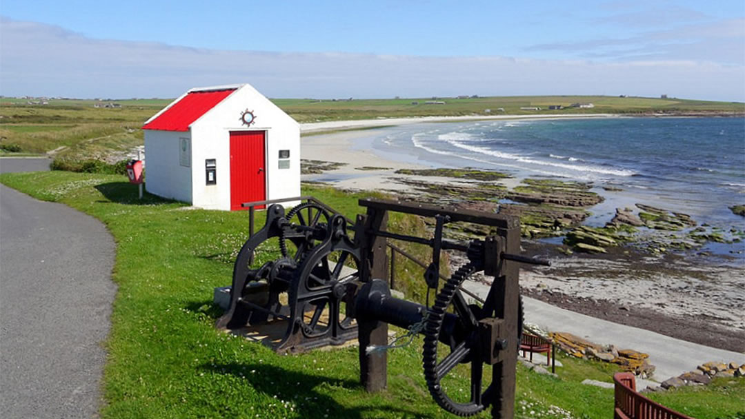
7) Newark Bay, Deerness
Newark Bay is a short distance along the coastline from Dingieshowe beach in Deerness, and there’s two ways to reach it. You can follow the signs to the slipway at Geo, which is a facility built by the Deerness Small Boat Owners Association and walk to the beach. Alternatively, there’s a signposted road directly opposite Deerness Stores.
Newark Bay is a yellow arc of sand with turquoise waters and a view southeast to the island of Copinsay. It’s possible to continue on to the Point of Ayre, which is a fascinating walks for geologists. Along the shoreline you’ll see black rocks underfoot – the remains of an ancient, bubbling lava flow. Close to some wind turbines, the dumpy rock stack Muckle Castle is a volcanic plug.
In the 1890’s a mermaid was seen at Newark Bay by many spectators and over the course of two or three summers. The mermaid would appear from May until August on days when the sea was calm, and the sun was bright. It stayed some distance from the shore, but the general consensus was that it had a little black head and mane, a white body, and long white arms that it used for swimming, almost like a human doing the back stroke. According to newspapers from the time, a person once attempted to shoot the creature for scientific examination. Though they struck the mermaid, it reappeared the next day, thankfully, unharmed. What do you think the Newark Bay mermaid was?
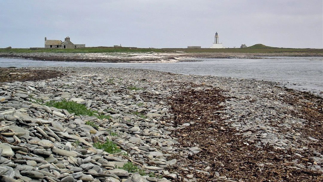
9) Start Point, Sanday
Visitors to Sanday will see Start Point lighthouse from some distance as the island is low lying (the cause of many wrecked ships) and the lighthouse, with its vertical stripes, is quite conspicuous. The lighthouse was built in 1870 by Thomas and Robert Stevenson, replacing an older beacon.
What you might not realise is that you may have to wait on a fine beach until the tide is low enough to cross to Start Point. This crossing point is known as Ayre Sound, and it is a journey that requires wellie boots. The waters run swiftly, making it unsafe to cross too early.
However, when you make it across to Start Point, you’ll enjoy walking around the massive lighthouse, and listening to the haunting calls of seals on the shore. Nearby there’s a Neolithic chambered cairn, called Mount Maesry, which is cool inside, and was once used by the lightkeepers as a store for their tatties!
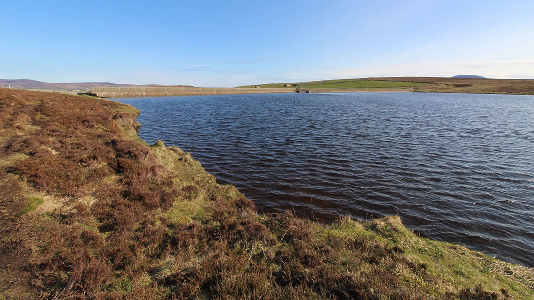
10) Stromness Reservoir at Yelda Water
A lovely walk on the outskirts of Stromness, the Loons can be reached by walking up Hillside Road, past the swimming pool, and then proceeding further uphill. It’s a wild place, with moorland patrolled by owls, and surrounded by low green hills.
The Stromness Reservoir at Yelda Water, known locally as the Stromness waterworks, can be found along this road, signposted uphill. There’s a place to park your car, and a flight of stairs to the reservoir itself. It’s a popular place for Stromness residents to visit as there are a number of brilliant walks to take, including a footpath around the reservoir itself, and tracks leading up the hill, with spectacular views across to Hoy and the Black Craig nearby.
The reservoir at Yelda was built in 1898 by Glasgow engineering firm W.R. Copland, and pipes supplied the town with excellent, filtered, clean water. This water was even delivered to the Grand Fleet anchored in Scapa Flow during wartime. By the end of WWI, the navy buying water had paid for the reservoir, and water rates were abolished for Stromness folk. Kirkwall had to wait much longer for good water. Taking a bottle of water if you were visiting patients in Kirkwall’s Balfour Hospital used to be the accepted thing to do. The Stromness Reservoir was improved later, in 1967.
Keen anglers will be delighted to know that there is a great tradition of open access to fish the lochs in Orkney, supported by the OTFA (Orkney Trout Fishing Association). The Stromness Reservoir is occasionally stocked by the OTFA so take your rod along – there are some great trout hiding in the dark depths!
We would like to give our grateful thanks to Patricia Long from About Orkney for information about Russadale Quarry and the Stromness Reservoir.
 By Magnus Dixon
Orkney and Shetland enthusiast, family man, loves walks, likes animals, terrible at sports, dire taste in music, adores audiobooks and films, eats a little too much for his own good.
Pin it!