Ten new hidden gems of Shetland
Previously, we wrote about some of the great places to visit in Shetland that don’t make the front cover of the tourist brochure! Here are ten more brilliant places to visit, hidden gems of Shetland that are a bit more unusual and less well known than St Ninian’s Isle, Scalloway Castle and Jarlshof!
Clousta is a beautiful corner of Shetland’s West Mainland, inconspicuously tucked away somewhere between Eid (Aith) and West Burrafirth. From here, walk to Noonsbrough, where you can find the ruined remains of a 2,000-year-old Iron Age broch.
See also:
- Ten hidden gems of Shetland
- Ten more hidden gems of Shetland
- Ten extra hidden gems of Shetland
- Ten further hidden gems of Shetland
- Ten additional hidden gems in Shetland
- Another ten hidden gems of Shetland
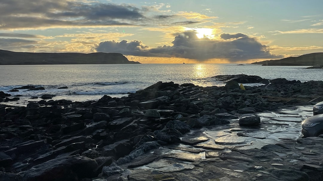
1. Da Sletts Coastal Path
Hidden in plain sight, Da Sletts Coastal Path is a local institution. This path, which courses a meandering track around Brei Wick, is never empty, with everyone from dog walkers and young families to lunch-break step counters and joggers. Along the narrow, wheelchair-accessible route, which begins at the Sletts and rejoins the main road close to the roundabout at Tesco, are interpretive panels dotted along the route, detailing the maritime history of the area, as well as unrivalled views across the bay towards Bressay and Lerwick Harbour’s Sooth Mooth.
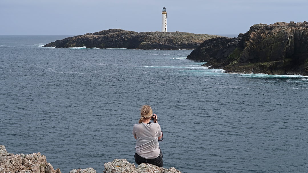
2. Skerries Lighthouse
The ferry to Skerries comes ashore at Bruray. From here, a walk to Long Ayre Beach and out towards the Head of Bloshin offers excellent views of the Stevenson-built lighthouse on the outlying Bound Skerry (1858) and the uninhabited island of Grunay.
Grunay, a natural shelter for the port at Bruray, was once home to the lighthouse keepers and their families. The first lighthouse in Skerries was temporary, erected on Grunay in 1854. The lighthouse cottages were bombed during the Second World War, causing the death of one woman who died in hospital from her injuries. The lighthouse was automated in 1972, and the keepers moved out. Out Skerries makes for a fantastic day out – just remember to pack a hearty picnic!
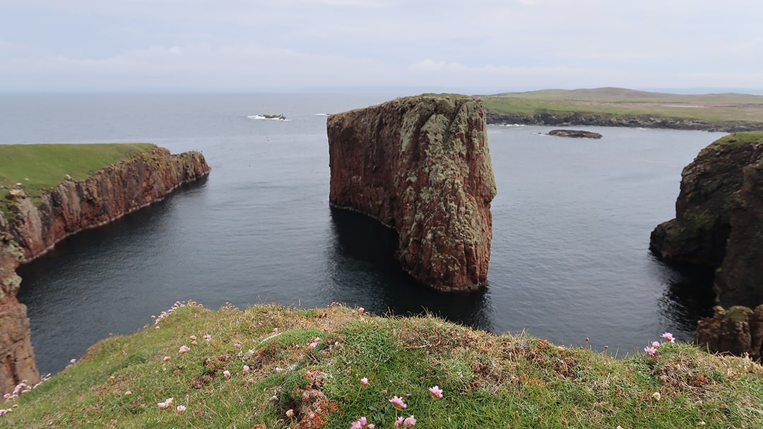
3. Papa Stour’s west coast
A mile offshore from the West Mainland area of Sandness is the island of Papa Stour, which boasts arguably the best coastline in Shetland. For hikers, the route between Hamnavoe and Virda Field, on the island’s west coast, is one of the best in Shetland, and from Virda Field, you have a panoramic view of the island. There are several options for walking, depending on the time you have on the island and the speed you can clock up the miles.
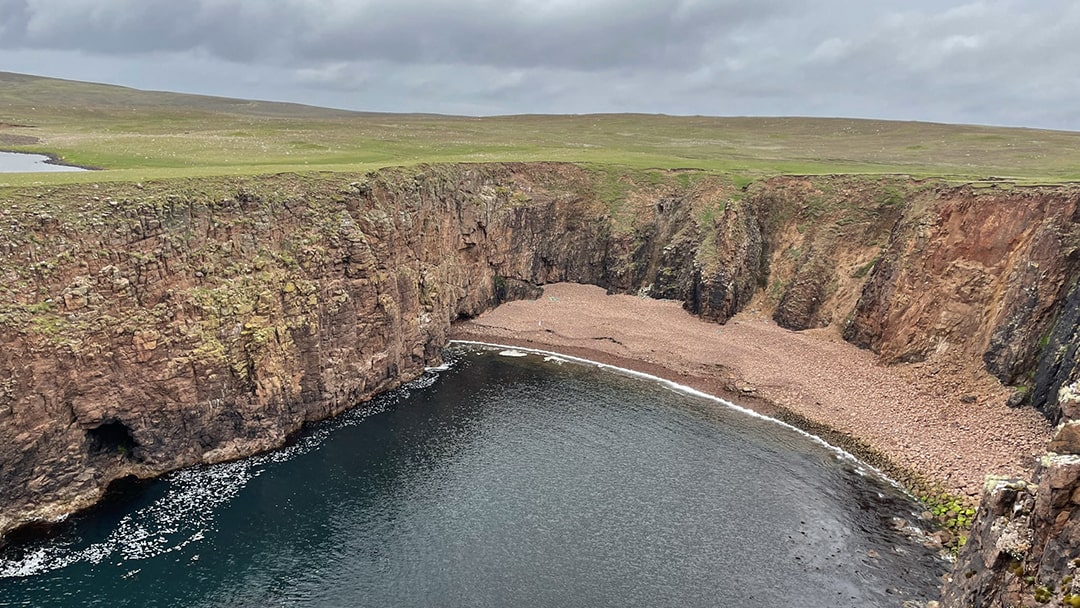
For those who are only in for a day, the section of coastline between Hamnavoe and Virda Field is best. This walk takes you to the dramatic west coast, including Kirstan’s Hole, Aeisha Head, and Virda Field, with views of Aesha Stack, Sula Stack, and Da Snolda. This moderate hike will take around 3 hours, but allow extra time for a picnic to enjoy the breathtaking views. For those visiting the island for longer, a full-island circular of 10.5 miles (17 km) will take you right around the coastline – allow at least 8 hours for this challenging island hike.
4. Gulberwick Beach and the Hollander’s Knowe
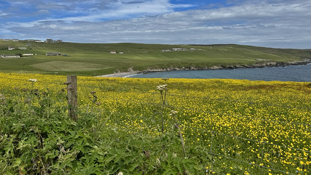
The unusually named Hollander’s Knowe is a place that always begs questions from visitors when it’s mentioned. From the 1500s, hundreds of Dutch fishing boats came to Bressay Sound each summer to fish. While here, they would trade with the locals. This trade ultimately led to the growth of what was to become Lerwick, but before this, they would walk the few miles southwest to Gulberwick to meet and trade with those from Scalloway. This halfway point is known as the Hollander’s Knowe and is marked by a small marker that looks uncannily like a gravestone on the knoll overlooking Gulberwick Beach, which is a cracking spot for a walk.
5. Fladdabister
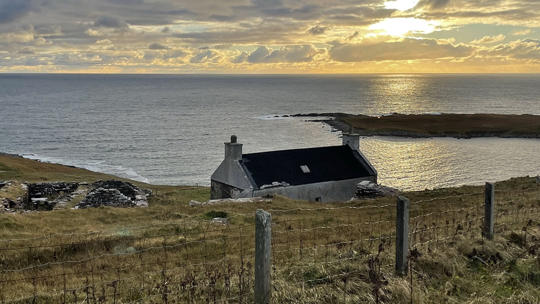
Fladdabister, on the road south from Lerwick, has been inhabited since prehistoric times and takes its name from the Old Norse for the “flat farm”. Dropping down into Fladdabister from the north allows for excellent panoramas with spectacular views of the indented coastline. Several picturesque abandoned stone houses show the vernacular architecture of the past and offer a glimpse of what the community would have looked like in the 19th century. Stop at the foot of the hill to visit the lime kilns, accessible through a signposted gate. Fladdabister’s fertile limestone valley was quarried throughout the 19th century, with lime sold for use in the building trade and as fertiliser to improve the peaty, acidic soils prevalent throughout Shetland.
6. Skaw Beach
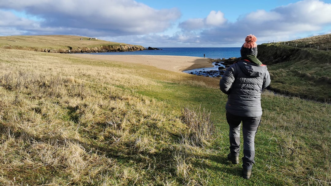
Travel to the most northerly island in Shetland, Unst, to visit the most northerly beach in the UK at Skaw. To get to Skaw, take the B9087 out of Haroldswick and follow the road towards Norwick before branching off along the Holsens road (signposted, though easily missed) for a few miles, passing the site of the SaxaVord spaceport until the road ends at The Haa (the most northerly house in Britain) in Skaw. Along the way, there are fantastic views down to Norwick Beach, as well as ruined croft houses to spot and the former Lamba Ness radar station. From The Haa, you are almost immediately on the beach, exposed to the east, with nothing standing in its way until Norway is out of view of other settlements.
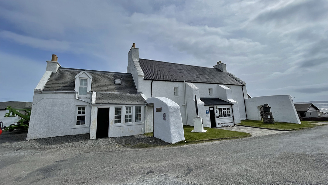
7. The Old Haa, Burravoe
Sticking to the North Isles, no trip is complete without a trip to The Old Haa Museum in Burravoe. The Old Haa (open seasonally) is a fantastic community museum that tells the history of Yell, with a small cafe serving tea, coffee and homemade cakes and an exhibition space. Burravoe is a village tucked into the southeast corner of Yell and sheltered by the long arm of Heoga Ness, which protects it from easterly gales and makes a fantastic walk. The Old Haa’s historic whitewashed building sits at the centre of the village, just a short stroll from the pier where otters are often seen.
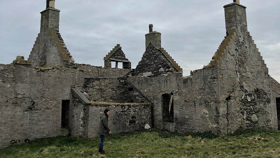
8. Windhouse
For those looking to explore more of Yell and those who don’t spook easily, be sure to stop at the uninhabited Windhouse. Just before Mid Yell, the foreboding, derelict silhouette of Windhouse comes into view on the crest of the hill. Reputed to be the most haunted house in Shetland, if not the whole UK, Windhouse is the site of an ancient settlement. The house itself has its foundations in an Iron Age broch, and recent excavations have revealed a centuries-old burial site within the house’s gardens. Steeped in mystery and legend, Windhouse attracts historians and ghost-hunters, both keen to unpick the magic of this mysterious house.
(Please note that the site is unstable, and entrance is forbidden, but photos and a short walk up the hill to view the house are allowed.)
9. Eshaness Graveyard
Sticking to the obscure, head to the North Mainland and pay a visit to the cemetery just before the Eshaness lighthouse. Tucked under the hill of this picturesque resting place are a few notable graves, including John Williamson, better known as Johnnie Notions. John Williamson’s grave states that he was the “pioneer inoculator against smallpox”, a bold claim for a self-taught island virologist! He began to dabble in vaccination in the 1770s as smallpox ripped through the islands every twenty years or so, killing up to one-third of the population with each outbreak.
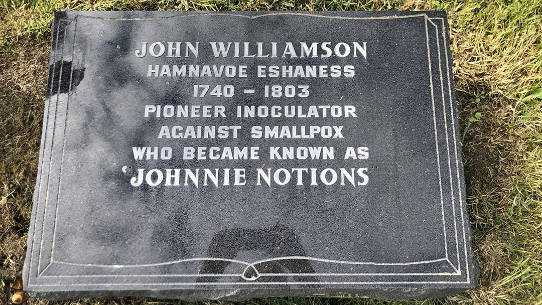
Although it’s unclear when he inoculated his first patient, Johnnie Notions was almost certainly inoculating in the late 1780s and early 1790s, but there can be little doubt that he had begun his trade long before that and, by the 1790s, he had acquired a remarkable reputation in Shetland having inoculated thousands without losing a single life.
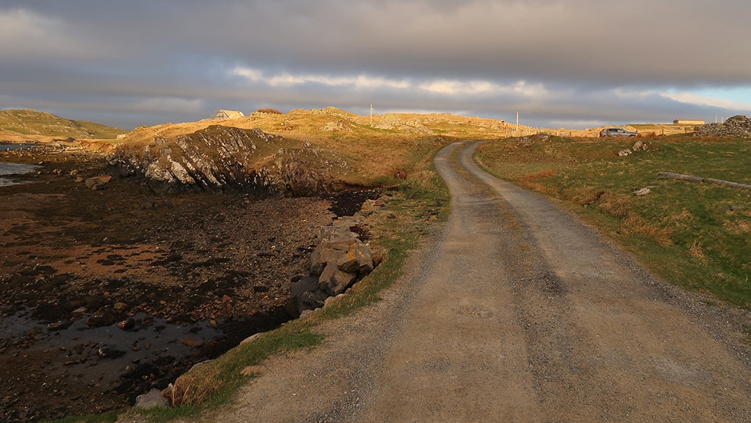
10. Noonsbrough, Clousta
Our final place is Clousta, an ‘old place’ – it has the sense that you’ve suddenly stumbled off the map. It’s a beautiful corner of Shetland’s West Mainland, inconspicuously tucked away somewhere between Eid (Aith) and West Burrafirth. From here, walk to Noonsbrough, where, as the name suggests, the ruined remains of a 2,000-year-old Iron Age broch still stand.
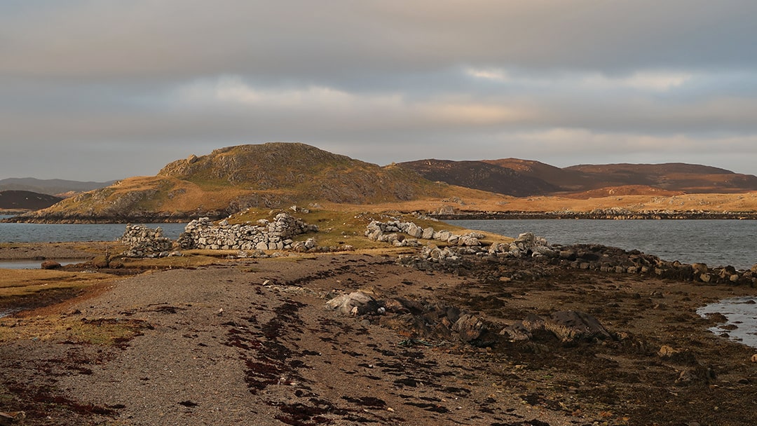
Like most Iron Age brochs in Shetland, Noonsbrough stands in ruin, collapsed in on itself, with only a metre or so of the original wall still standing. However, the inner and outer walls can be seen from the top. Surrounding the outer broch wall, a later boat ‘noost’ structure has been added to the broch, creating a sheltered space for hauling up boats in the winter to protect from the worst of the weather.
 By Laurie Goodlad
Born and raised in Shetland, Laurie loves the unique history and culture there so much that she started her own tour company offering visitors the chance to see the isles through the eyes of an islander. Find out more at www.shetlandwithlaurie.com
Pin it!