Chris Dyer: Exploring the history of Papa Stour
Shetland-based archaeologist and historian Chris Dyer, of Garths Croft Bressay, explores the beautiful and historically-fascinating island of Papa Stour, an easy day trip via a 40 minute ferry journey from West Burrafirth on the Shetland Mainland.
Today, whilst there are under twenty permanent residents, crofting and agriculture remain a crucial aspect of the economy of Papa Stour with many commuting to the island to work with flocks of sheep.
The small island of Papa Stour is situated off the west coast of the Shetland Mainland. Its Old Norse name of Papey Stóra, translating as ‘large island of the priests’, references the arrival of early Christian missionaries in the pre-Viking Pictish era of the mid to late first millennium AD.
Replete with human history stretching back over five thousand years, Papa Stour is divided by a sinuous post-medieval hill dyke of turf and stones, separating the fertile and formerly populous eastern side from the beautiful and windswept Atlantic coastline containing dramatic cliffs, stacks, sea caves and an array of well-preserved prehistoric sites.
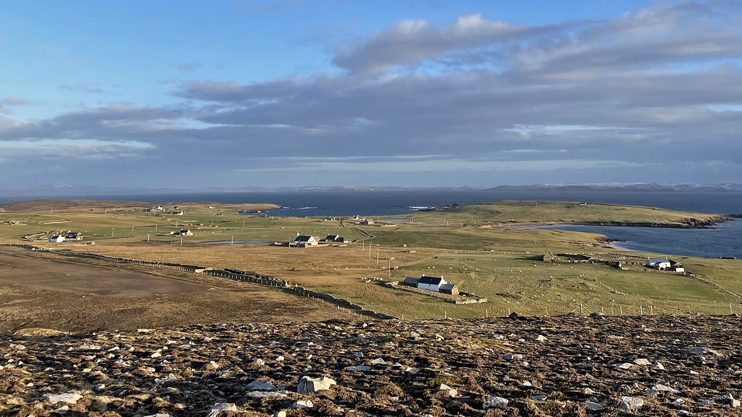
Prehistoric and Neolithic Settlements in Papa Stour
A Neolithic chambered cairn can be found at the summit of the Hill of Feilie, with spectacular views towards Sandness and out to Foula. Complemented by stone-built linear boundaries, homesteads and burnt mounds on the west side of the island, this indicates that the landscape, with exposed bedrock and little topsoil depth, was not always as challenging for habitation during prehistoric times.
An enigmatic collection of buildings were discovered at the summit of the precipitous Maiden Stack and also at Brei Holm, as well as a circular, open ring of boulders at Housa Voe. This circular site has been interpreted as a meeting place or assembly, with the 18th-century antiquarian George Low stating it was a place for duelling or for local gatherings of a consultative and judicial nature during the Norse-medieval period.
Home to Shetland’s oldest surviving document
Shetland’s earliest surviving written record references the tumultuous events that took place at Da Biggings in 1299 when Ragnhild Simunsdatter confronted Thorvald Thoresson, Duke Hakon Hakonsson’s representative in Shetland, the lord of Papa Stour. She accused him of taking higher rents from the farm of Breksætr (Bragaster) than was due and the case was heard before the Lawthing, Shetland’s parliament, at Tingwall.
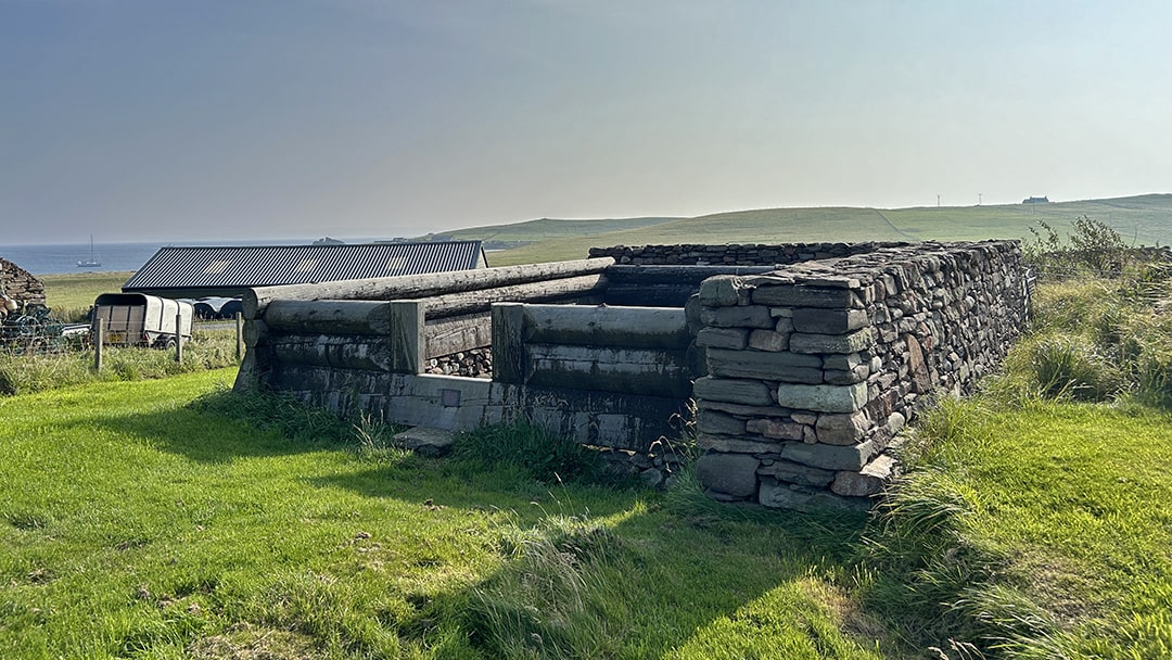
The document references Duke Hakon’s stofa on Papa Stour and archaeological excavations on the site between 1977 and 1990 by Dr. Barbara Crawford of St. Andrew’s University identified a 13th-century structure complete with wooden floor and protective stone walls. Subsequent collaboration between Norwegian and Shetland craftsmen led to the erection of a partial reconstruction of the historic building on its original foundation.
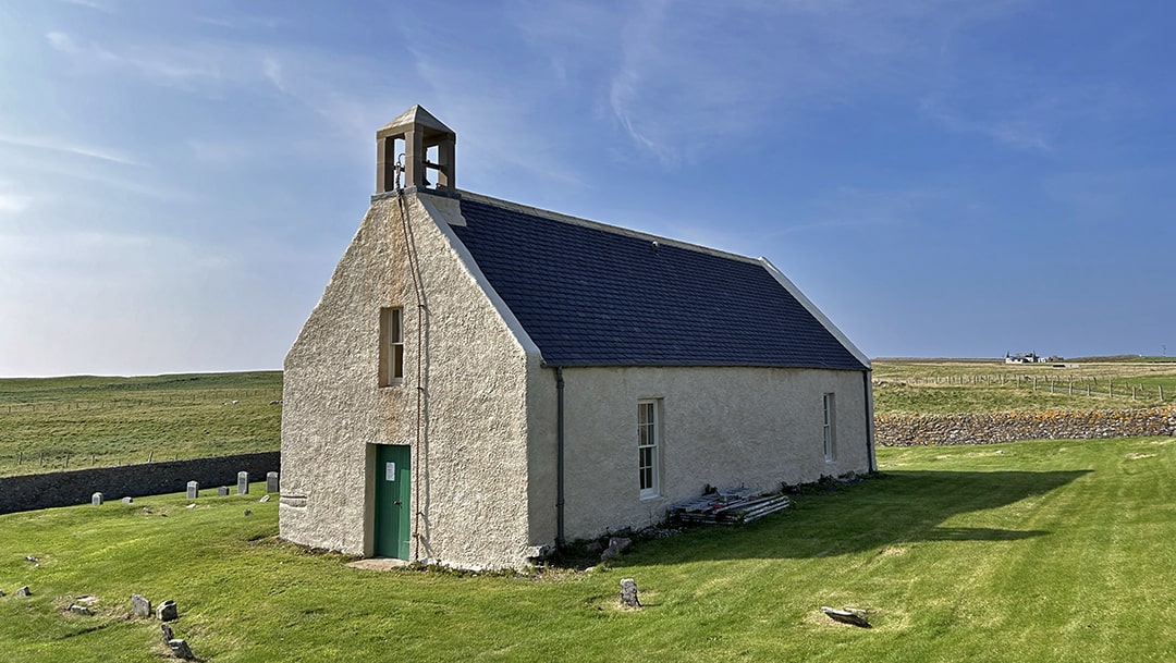
The historic Papa Stour Kirk
The present kirk was established in 1806, replacing an earlier structure on site and a historic chapel at the Sneeans to the south. The western gable features a fine memorial stained-glass window to the six men from Papa Stour who lost their life during the Great War. It was installed in 1921 and the colourful scene of Jesus calming a storm is a rare surviving example of the work of artist Victor Noble Rainbird.
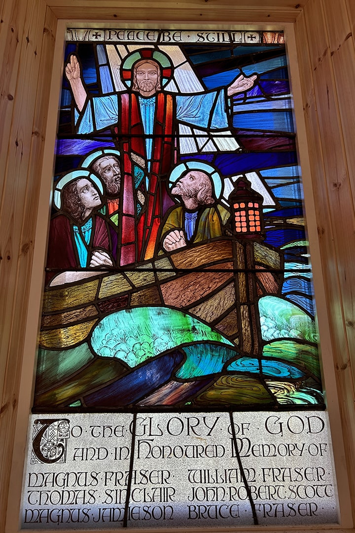
Following deconsecrating in 2016, the building is under the ownership of the Papa Stour History and Community Group with positive ongoing restoration works including repairs to the roof, bell tower and new lime harling designed to facilitate an inclusive community resource. The group also maintains a welcoming ferry waiting room, refreshment facilities and bathrooms.
Other surviving sites of interest
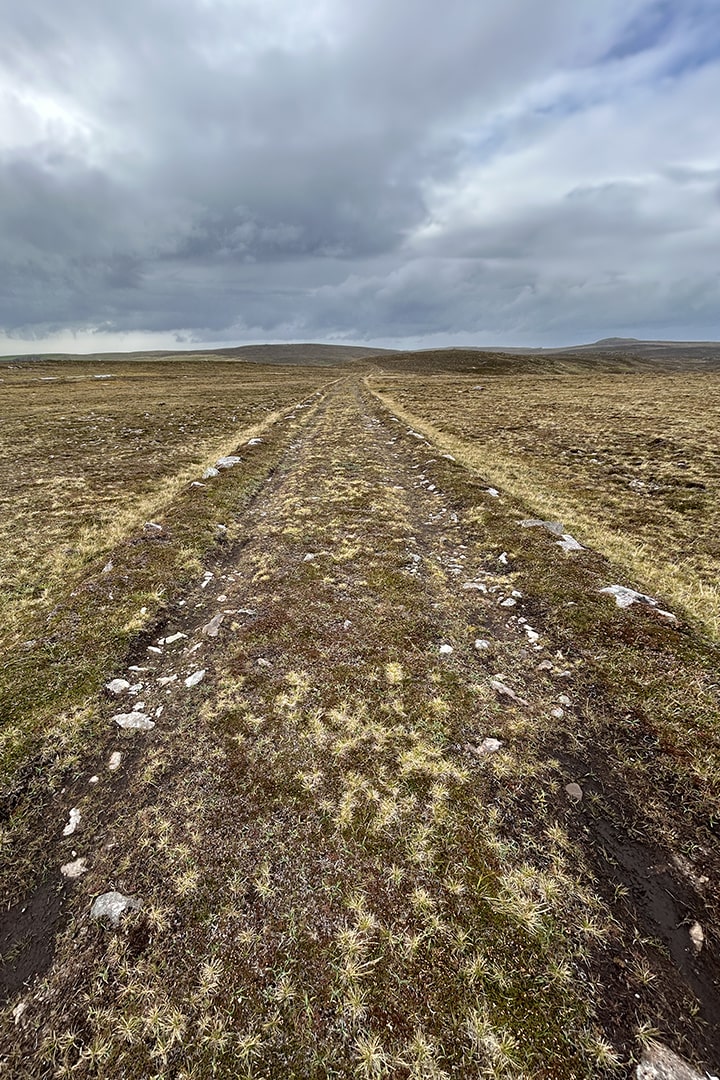
Beyond the hill dyke and downhill from the waterworks on the western side of the island is one of two well-preserved stretches of meal road that continues for over a kilometre towards the former merchant store at Hamnavoe House. This track, designed for small carts and ponies, was constructed as part of a nineteenth century famine relief scheme with flour, or ‘meal’, being given in lieu of payment. A second such road heads west from Hurdiback for over 700m and continues north of Gorda Water.
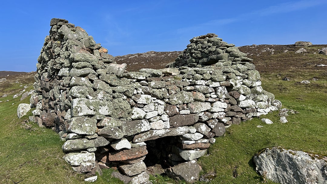
A series of post-medieval water mills on the western hill ground is indicative of the processing of arable crops of oats and barley into flour. Also called horizontal, or Norse mills, the surviving structures south of the Dutch Loch and also west of the Loch of Aesha are complete with dam and leat systems to channel the water.
A declining population
During the 19th-century, the population of Papa Stour was at its peak following the opening of the Crabbabery Fishing Station at West Voe alongside a densely occupied, fertile crofting landscape with 382 people recorded on the 1841 census.
Unfortunately, the centralisation of the fish curing industry in Lerwick and lack of available peat for fuel on the island influenced a steady decline to the extent that by 1940, only one hundred remained and this continued to fall further until advertising in the national press saw the population stabilise for a time after the 1970s.
Today, whilst there are under twenty permanent residents, crofting and agriculture remain a crucial aspect of the economy with many commuting to the island to work with flocks of sheep.
A wild and dramatic coastline
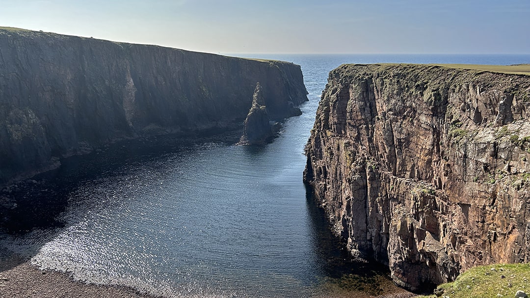
The dramatic Atlantic coastline of Papa Stour comprises a beautiful collection of steep, narrow-sided geos, natural arches, sea stacks and boulder beaches, popular with walkers, kayakers and divers alike.
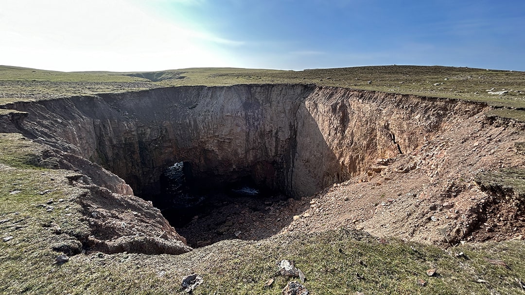
The geology is principally volcanic, with eroding lava and ash deposits creating a spectacular array of inlets and sea caves. The ‘Hol o Bordie’ stretches underground for over 300m to the north of Virda Field whilst the full force of the ocean can be viewed through the collapsed sea cave of Kirstan’s Hole.
Papa Stour can be visited year round but it is advisable to book ahead to ensure ferry travel. For the current timetable, see Timetables – Shetland Islands Council or phone 01595 745804.
 By Chris Dyer
Chris Dyer is a Shetland-based archaeologist and historian with more than 20 years of experience, and is the owner of the sustainable agricultural holding, Garths Croft, in Bressay.
Pin it!