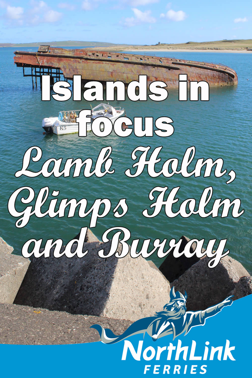
Islands in Focus – Lamb Holm, Glimps Holm and Burray
The Orkney islands of Lamb Holm, Glimps Holm and Burray are part of a chain of islands, joined to the mainland by the Churchill Barriers, which were built during the Second World War. These causeways locked the eastern gates to the sheltered waters of Scapa Flow, the British Fleet’s base at the time.
Burray Village was a once busy herring port in the 19th century and the Sands Hotel started life a herring station. However the fishing industry in Burray ended after the construction of the Churchill Barriers prevented easy access to the North Sea.
South Ronaldsay lies at the end of the chain, and there’s an Island in Focus feature devoted solely to it. We hope you enjoy this guide to the breathtaking islands of Lamb Holm, Glimps Holm and Burray.
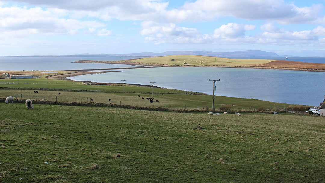
Lamb Holm
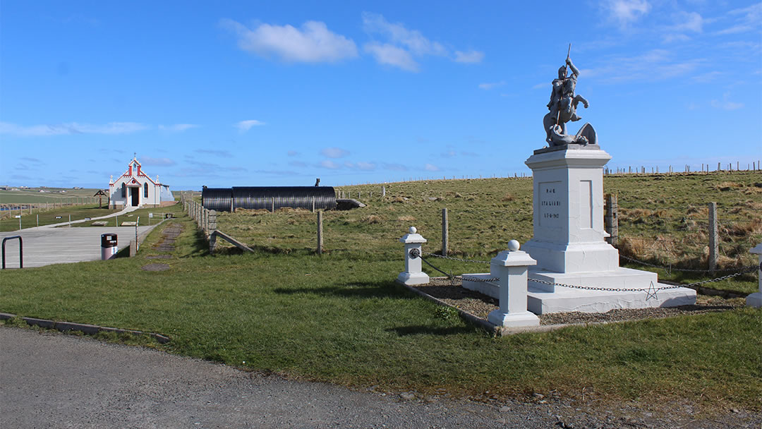
Across the first barrier from Orkney’s Mainland, Lamb Holm’s best known attraction is Orkney’s Italian Chapel, which once sat in the heart of a prisoner of war camp on the island. The chapel was built from odds and ends by the Italian POWs working on the Churchill Barriers, and it is beautiful indeed. There’s a lovely beach on Lamb Holm, and on the hill above the Italian Chapel, a private airfield.
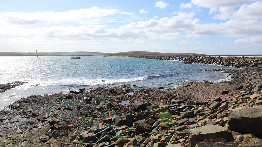
At the other side of the Lamb Holm you’ll find one of the quarries used for stone to build the barriers, an old pier, and Barrier number 2. This barrier is exposed to rough seas, so can be hazardous to cross in wintertime. Before the barriers were built, blockships were sunk around the islands to deter enemy ships and submarines. Several rusting shipwrecks still pierce the water’s surface today.
Glimps Holm
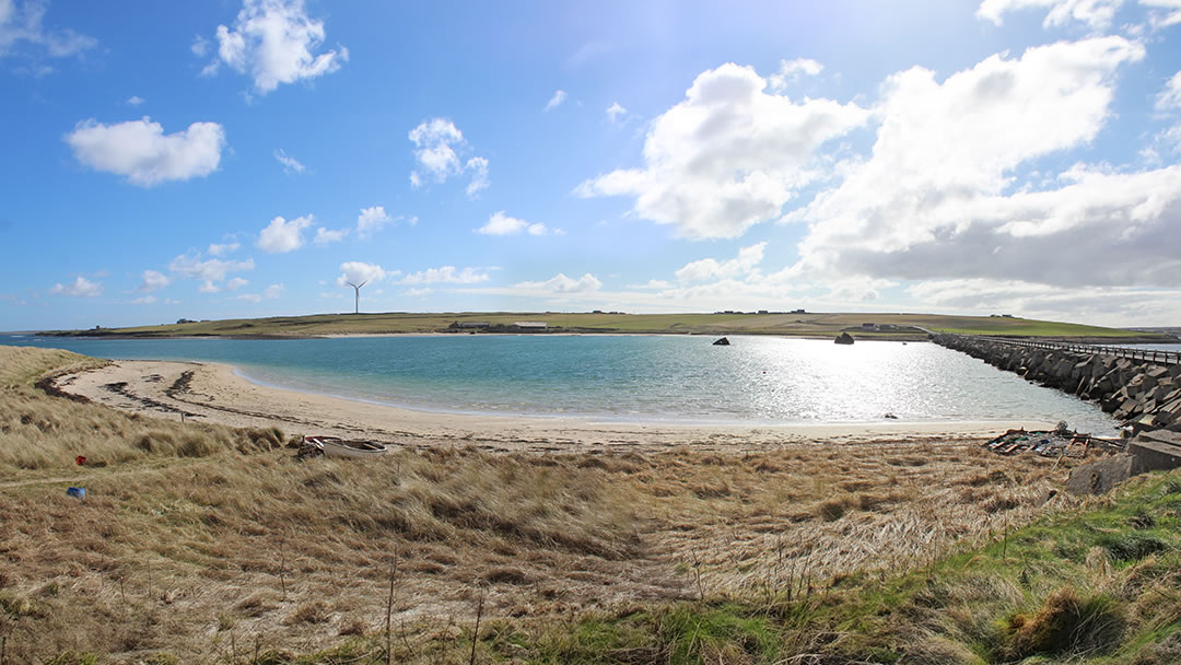
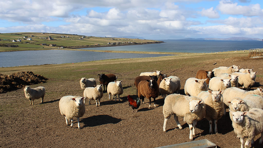
At the other side of Barrier number 2, Glimps Holm is a tiny heathery island, with a lovely curving beach has built up on one side. The beach is very sheltered so it’s popular with walkers, and families often play in the glittering waters. Low cliffs fringe the other side of Glimps Holm, and the island’s only inhabitants are flocks of sheep.
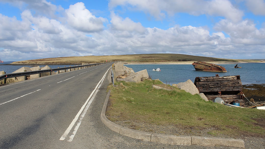
Barrier number 3, which stretches from Glimps Holm to Burray, was the first Churchill Barrier to be completed. The blockships found at either side of Barrier number 3, including the whale-like hull of the Reginald, built in 1878 and sunk in 1915, are particularly impressive.
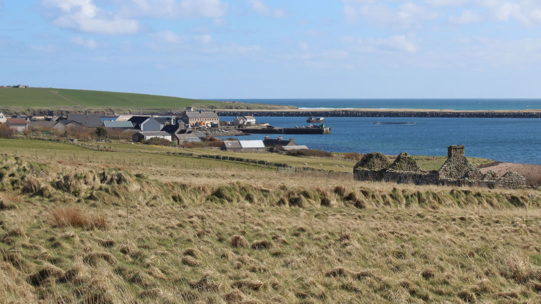
Burray – the north shore
After crossing Barrier number 3 onto Burray you’ll arrive at Warebanks. During the Second World War, this north shore was the site of another POW camp, another Italian Chapel, and a construction quarry. Railway tracks were used to transport the material from the blockyard to the Barriers.
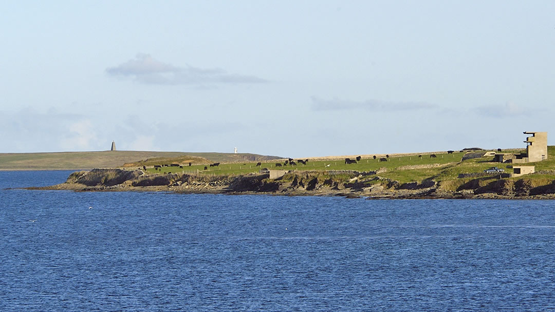
These days, on the north shore of Burray, there is a lovely beach, the remains of a wartime coastal defence battery and two ruined Iron Age brochs. The name Burray comes from the Old Norse Borgarey for ‘Broch Island’.
Both brochs are on private land, and West Broch is hard to spot, because stone was removed from it and then, in 1940, the coastal gun battery was built on top. After the construction of Barrier number 3 made the area safe in 1943, the gun was moved to Graemsay.
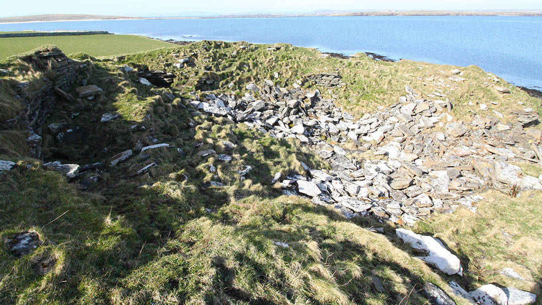
East Broch stands tall further along the shore. It is still an impressive sight, even though the broch has collapsed in on itself. There was once a Neolithic chambered cairn nearby too, which contained skeletons of humans and dogs. It was destroyed after being excavated in the 19th century.
Back on the main road through Burray, there’s an impressive viewpoint at the top of the hill looking down on Warebanks. Much of Burray is agricultural land.
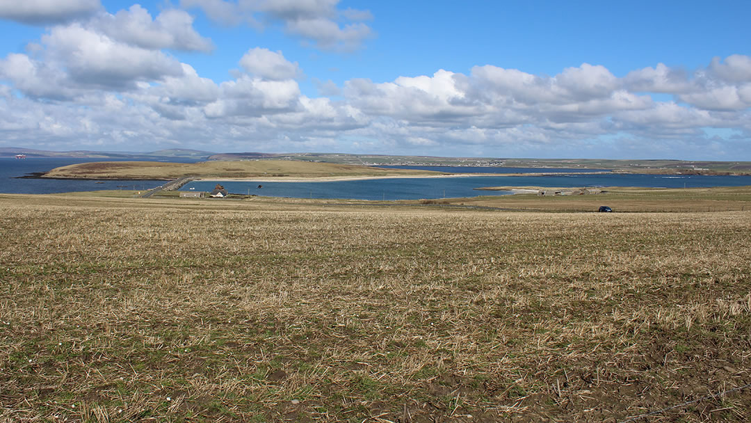
The road through Burray continues downhill and crosses an ayre, which is often mistaken for another barrier. The ayre is a shingle beach with Echnaloch at one side and Echnaloch Bay at the other. Both the loch and shore are good places to spot waterfowl.
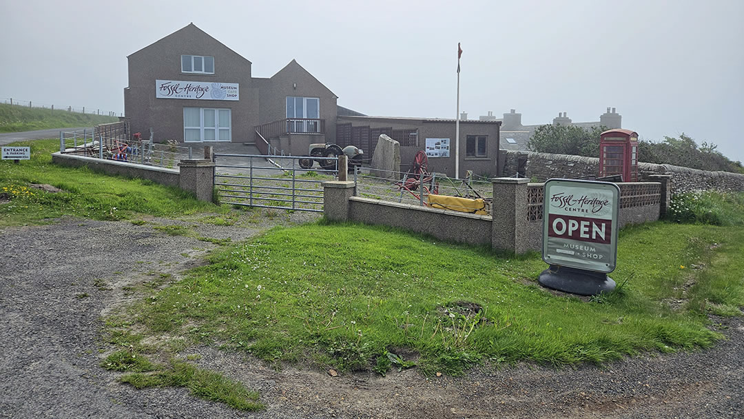
Burray and the Orkney Fossil and Heritage Centre
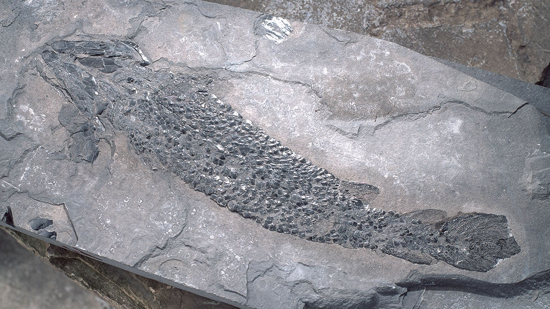
The Orkney Fossil and Heritage Centre was created from 19th century farm buildings by a local builder, Leslie Firth, who was fascinated by fish fossils. He began his collection after discovering blue fish scales hidden within the slate at Cruaday Quarry in Sandwick. The Orkney Fossil and Heritage Centre displays fossils that Lesley and other collectors found, and show how, 385 million years ago, Orkney was covered by a lake.
Also, in the Orkney Fossil and Heritage Centre there’s a room devoted to wartime Orkney, an archive room, and upstairs, artefacts from the past, many of which were collected by Leslie, with his father Ernest and brother Eoin.
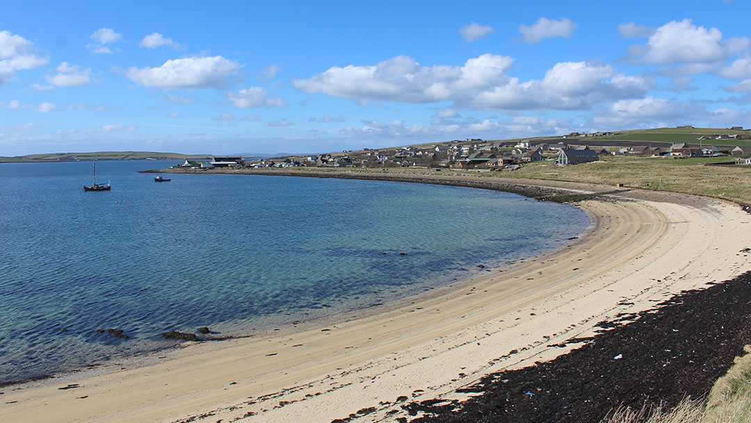
Burray Village
Charming Burray Village was a busy herring port in the 19th century, along with St Margaret’s Hope in South Ronaldsay and Whitehall in Stronsay.
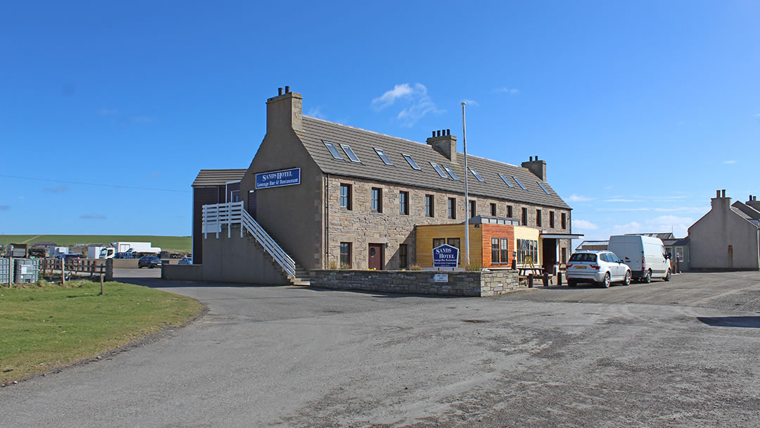
The Sands Hotel was once a herring station, built in 1860, where women with flashing knives gutted, salted, and packed the day’s catch. For many years, Burray Village also had a boat building yard with an exceptional reputation.
Herring fishing ceased in 1913, and the fishing industry in Burray ended after the Churchill Barriers prevented easy access to the North Sea. It is difficult to comprehend the dramatic effect the barriers must have had on these self-contained island communities, now able to easily access work, activities, and shopping on mainland Orkney.
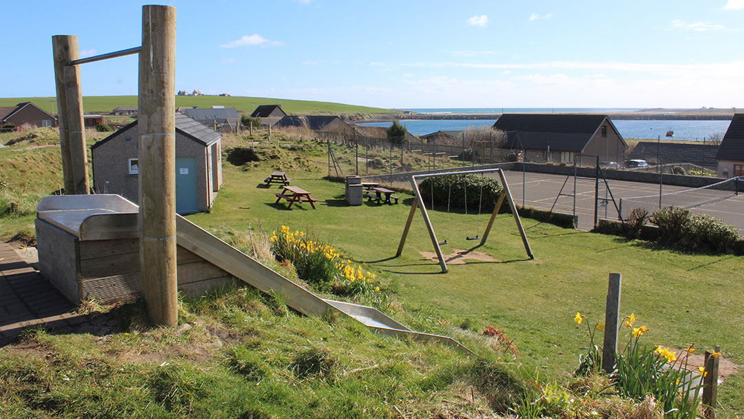
Burray village has a nice play park for children, and most of Burray’s population (approximately 400) live here.
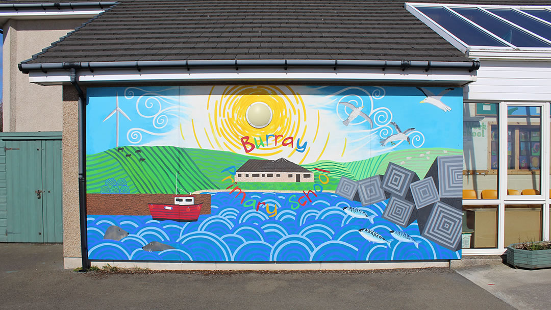
We were quite taken with the mural on display at Burray Primary School!
Burray beaches and Ancient Churches
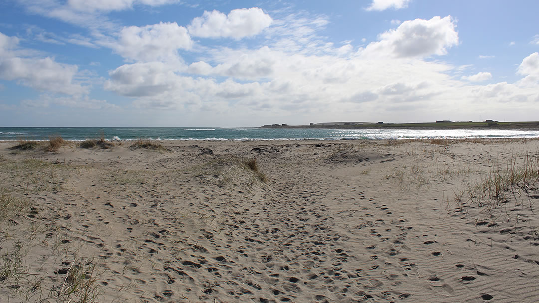
Barrier number 4 stretches from Burray to South Ronaldsay. These days a vast amount of sand has built up against the barrier, burying blockships which were previously underwater. These sands are home to Orkney’s only breeding colony of Little Tern, which are very rare indeed.
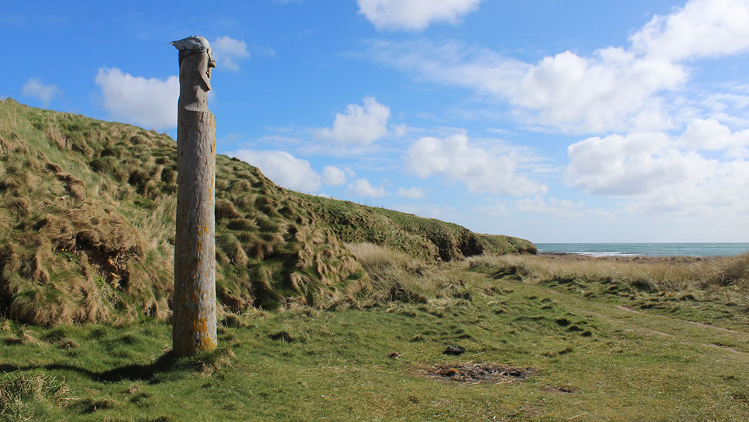
Standing over the beach you’ll spot a Viking totem pole, complete with metal helmet, created in 2002 by Willie Watt from driftwood he found.
Continue along this Burray coast and the shore becomes dark and jagged – there are exposed reefs at Wife’s Geo. At the far east of the island, gun emplacements can be seen, and small rectangular lochs. These were once the foundations of wartime buildings.
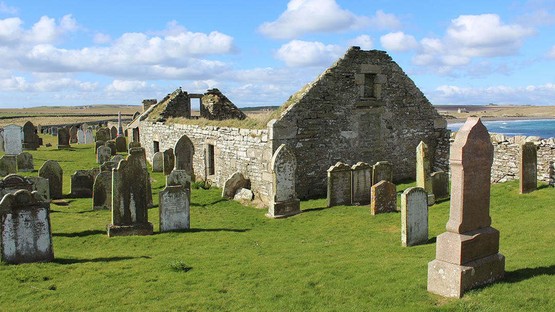
By taking a road to east of Burray you’ll arrive at the ancient Saint Lawrence Kirk. Possibly built from the stones of a broch, it was in use from the 12th to the 19th century. In the 17th century, a boat belonging to a man from Greenland was said to have hung from the roof! Though Saint Lawrence Kirk is now a ruin, the kirkyard is still in use, and it’s a fantastic place to be on a breezy summer day.
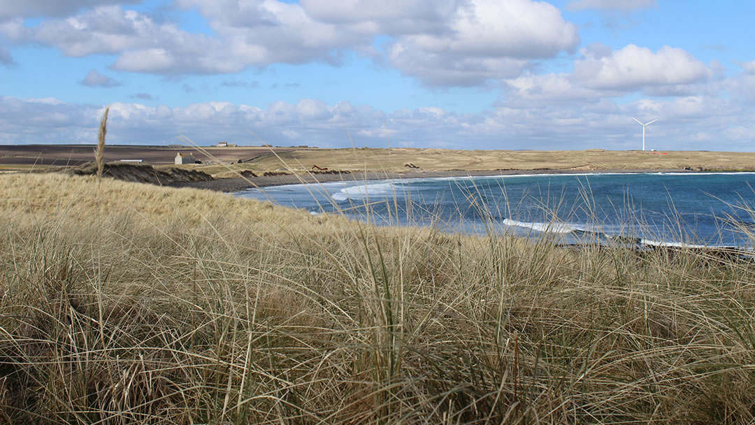
Peering over the wall of the kirk, you will see the magnificent dunes at the Bu Sands. This beach is now being quarried for sand, so is best viewed from afar. During the excavation, Iron Age discoveries were unearthed!
Other Burray stories
At the west of Burray there’s a fifth causeway over to the island of Hunda. Though narrower than the other Churchill Barriers, it strengthened the natural causeway between the two islands, and was built during wartime to stop surface craft. The island and barrier are on private land however, so Hunda should be admired from a distance.
In 1778, novelist Mary Brunton was born Mary Balfour in Burray. She wrote the popular book Self-Control in 1811, followed by Discipline in 1814 and Emmeline in 1819.
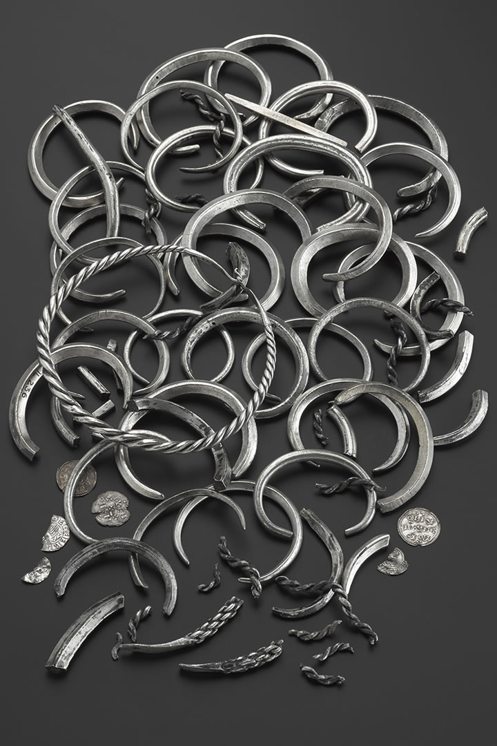
One of the largest Viking hoards in Scotland was found in 1889 on a hill on Burray’s west side. George Petrie was cutting peats at North Town Moss when he discovered a wooden bowl, which fell to pieces, revealing silver treasure! Over 140 items, including coins, armlets, and necklets from 998AD were discovered. The items can now be found in the National Museum of Scotland, but at the time they were briefly exhibited in a local shop window for all to see.
 By Magnus Dixon
Orkney and Shetland enthusiast, family man, loves walks, likes animals, terrible at sports, dire taste in music, adores audiobooks and films, eats a little too much for his own good.
Pin it!